Type and hit enter
 After
After
 Before
 After
After
 Before
Type and hit enter
Remote sensing is a technology used to gather information about objects and phenomena from a distance without physically touching them. It involves the use of sensors and instruments mounted on aircraft, satellites, drones, and other platforms to capture data from various parts of the electromagnetic spectrum.
This data can be used to create detailed maps, monitor changes in the environment, analyze natural resources, and much more. Remote sensing has numerous applications in fields such as agriculture, urban planning, disaster management, and natural resource management, making it an essential tool for decision-making and research.
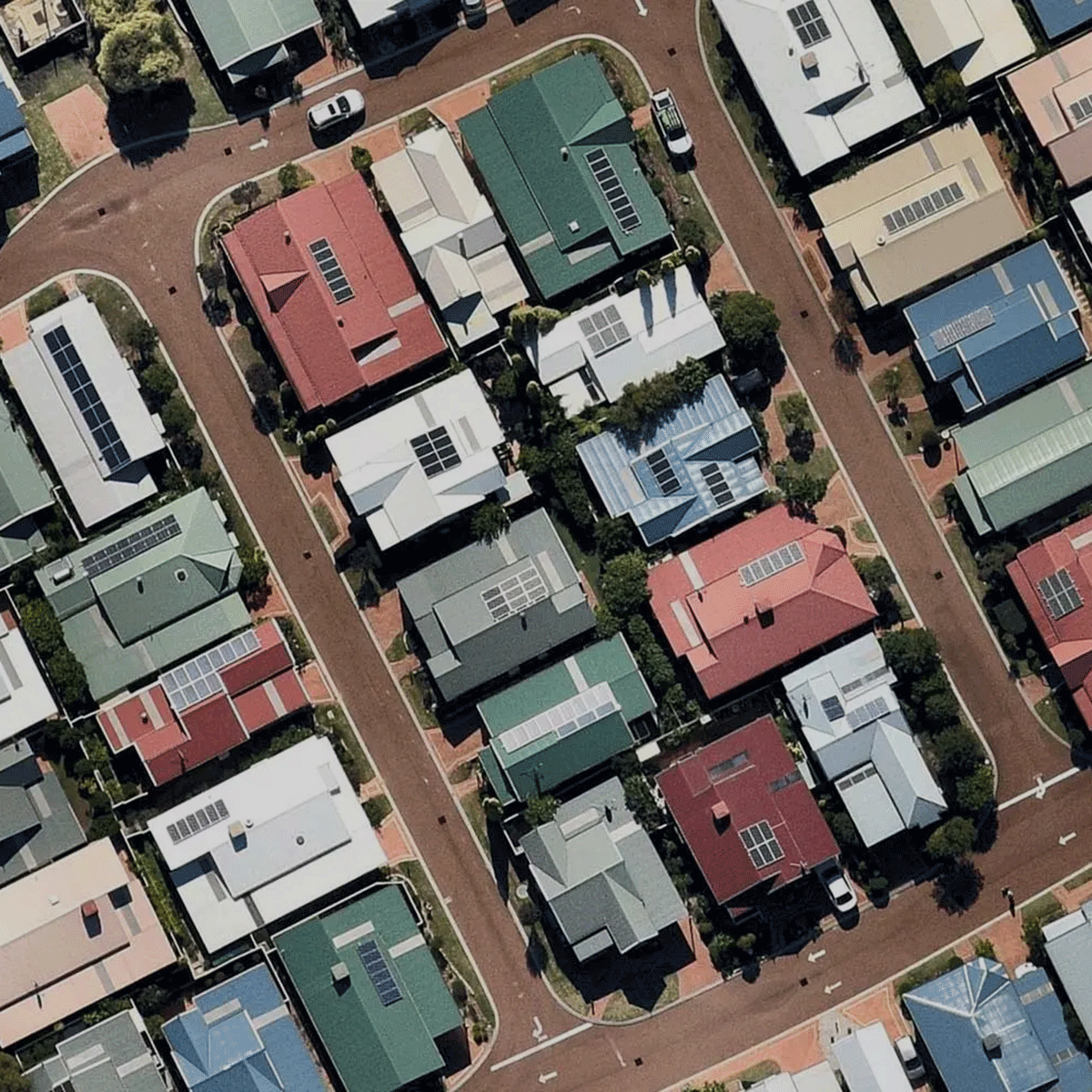
Feature extraction is a key analytical service in remote sensing that involves identifying and extracting important features from raw remote sensing data. This process helps to reveal patterns, structures, and characteristics of the Earth’s surface, such as vegetation cover, land use, and topography.
Feature extraction enables the creation of high-quality maps and other geospatial products that can be used for various applications, including natural resource management, urban planning, and environmental monitoring.
By utilizing advanced algorithms and techniques, remote sensing experts can extract meaningful features from complex data sets, providing valuable insights and informing decision-making.
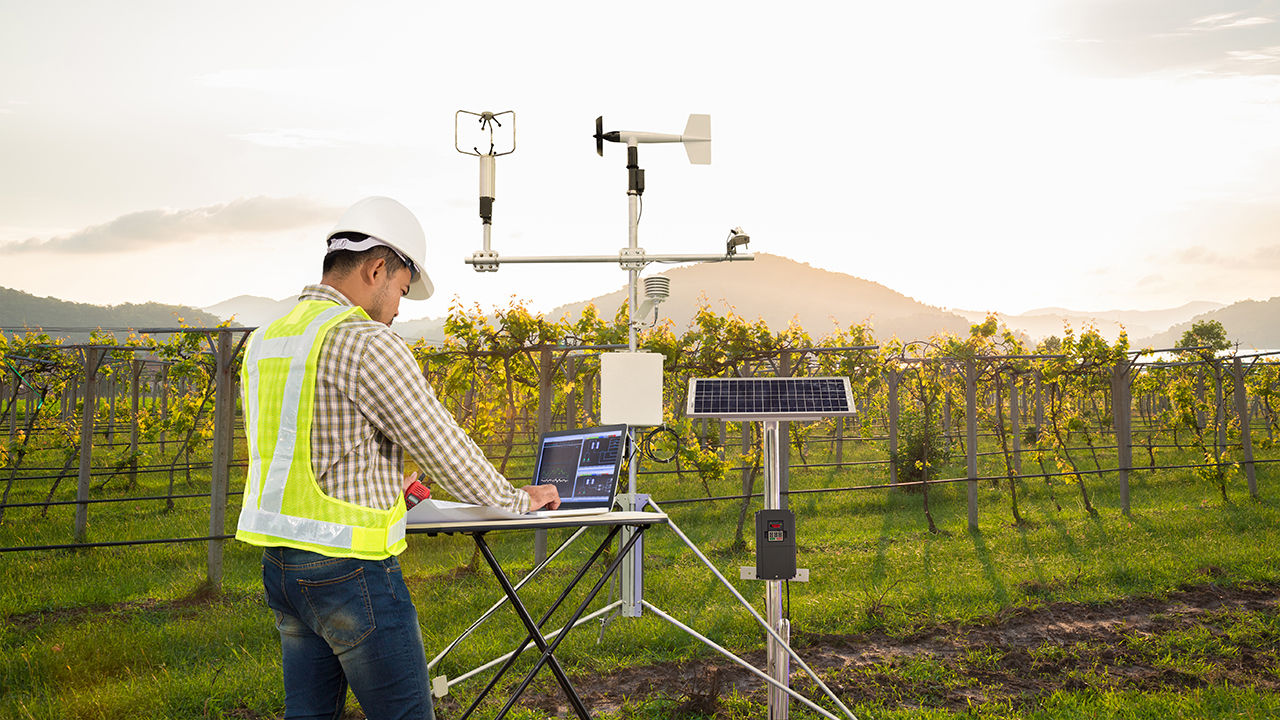
Vegetation monitoring is a vital component of remote sensing with applications in agriculture, forestry, and conservation. It involves using sensors to observe changes in plant growth and health over time. By monitoring vegetation, remote sensing experts can identify areas of concern, such as the presence of weeds, and assess the overall health of vegetation in an area.
By analyzing remote sensing data, experts can detect changes in vegetation health, track the spread of invasive species, and assess the impact of natural disasters on vegetation. This information can inform land management decisions and help to protect and preserve our natural resources.
After
Before
Satellite images of Drought in Paraguay, taken 2017 (Before) and 2020 (After). (NASA, Images of Change)
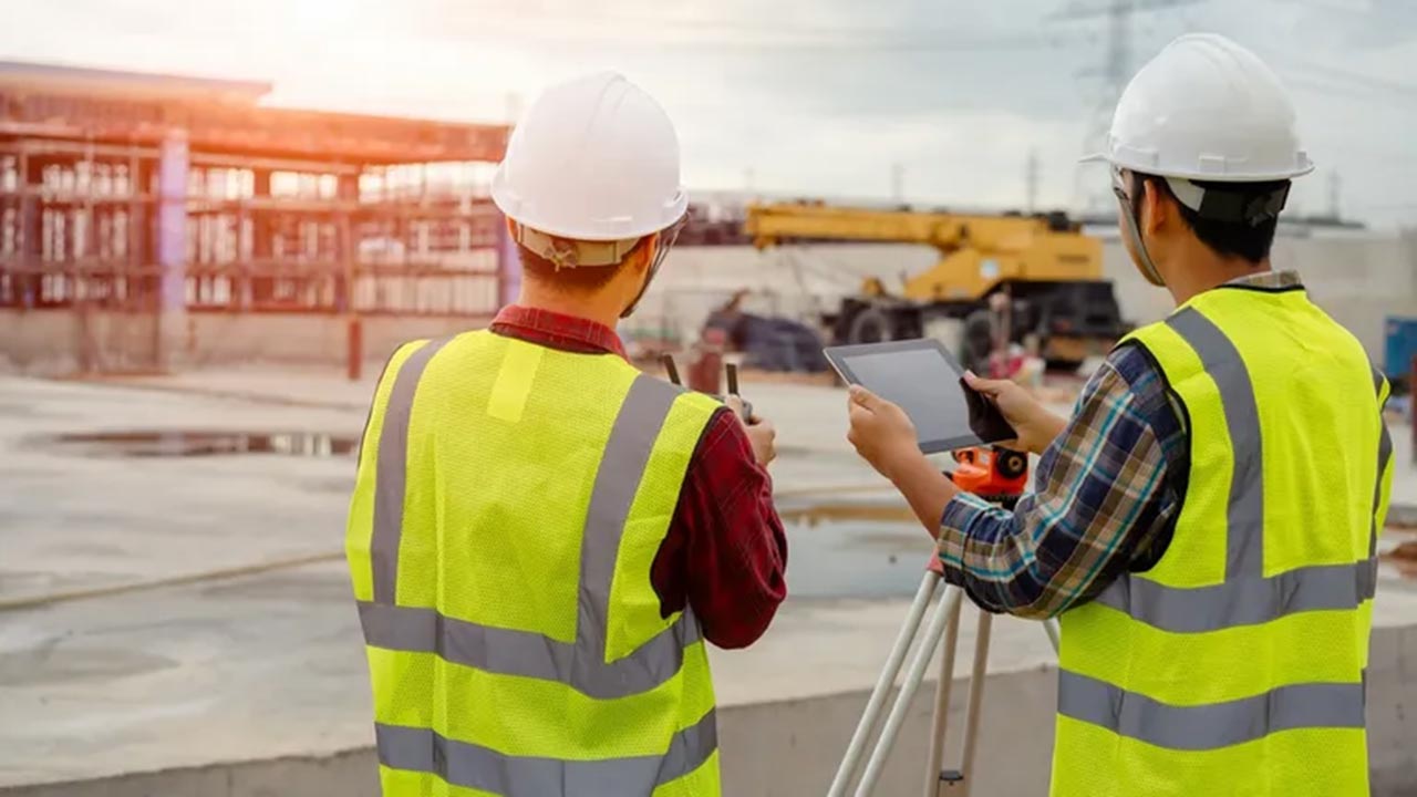
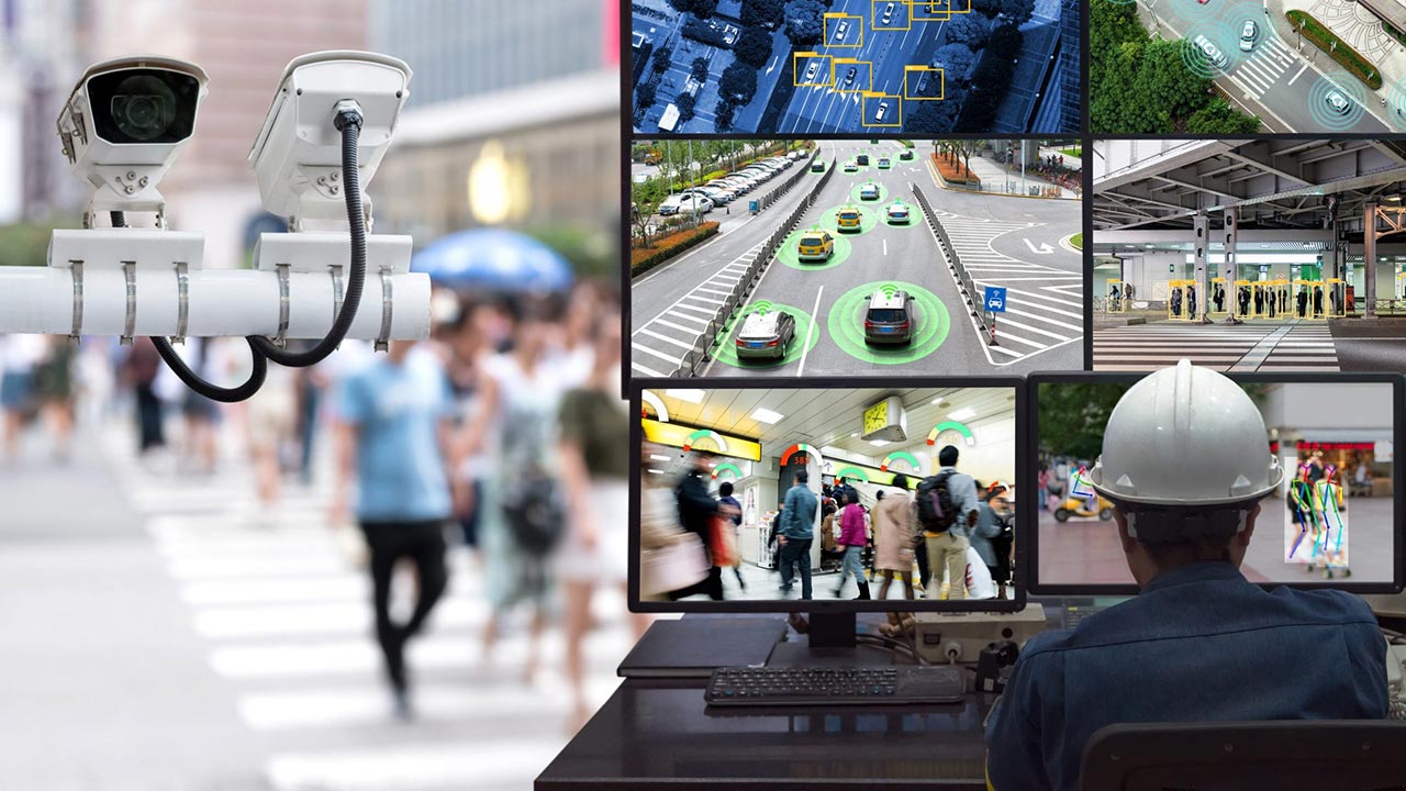
The use of IoT and CCTV cameras for remote observation is becoming increasingly common in various fields, including security, transportation, and urban planning. This technology allows for real-time monitoring of remote locations, providing valuable insights and enabling prompt action.
IoT sensors can be used to monitor air quality, noise levels, and other environmental factors, providing valuable data for research and urban planning.
IoT sensors can be used to monitor the status of critical assets, such as bridges or power lines, enabling early detection of maintenance issues and reducing downtime.
IoT sensors and CCTV cameras can be used to monitor public spaces, buildings, and other areas, providing a deterrent against crime and enabling quick responses to security incidents.
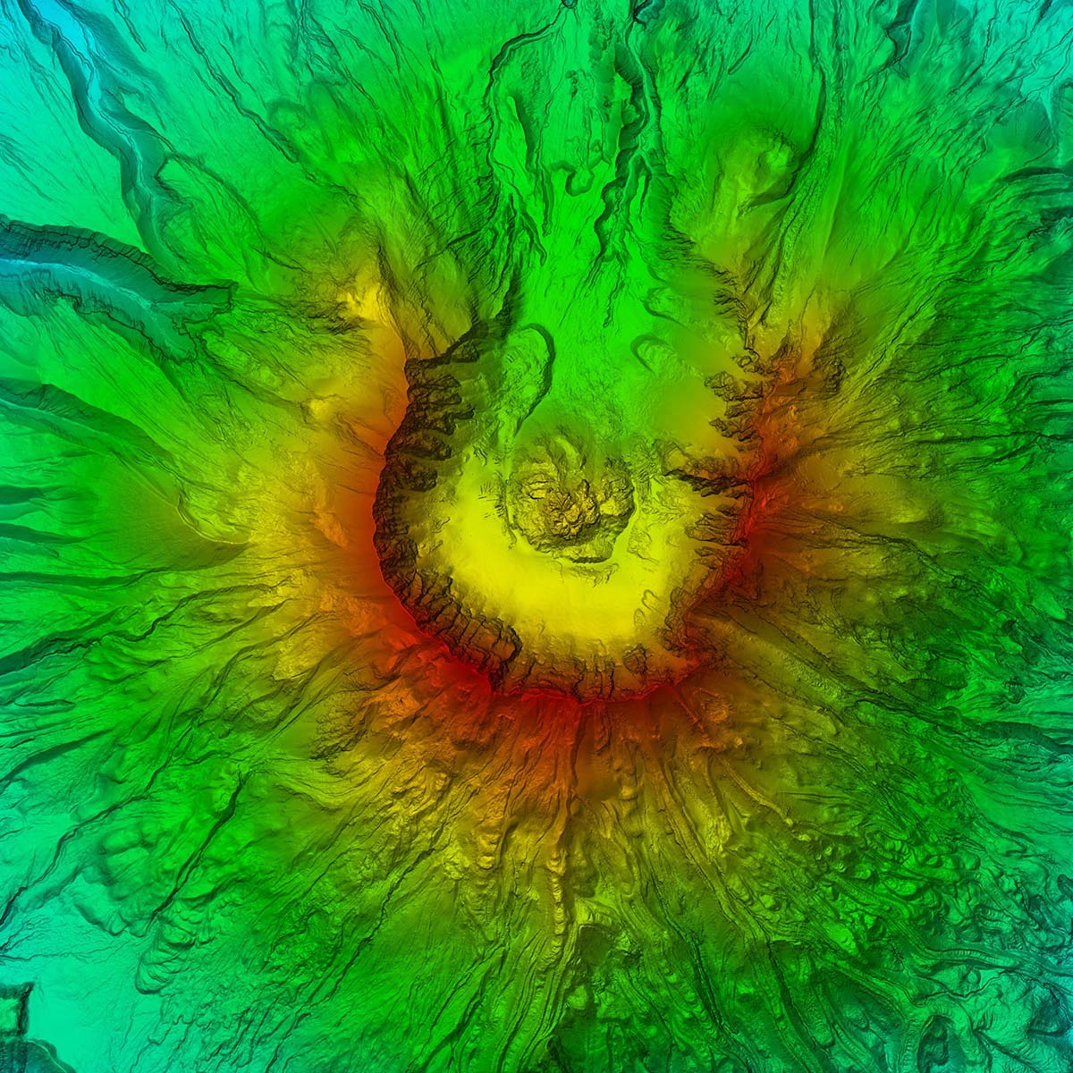
Lidar data is a powerful tool in remote sensing that involves using lasers to collect detailed information about the Earth’s surface. By using lidar data, experts can conduct remote inspections that are safer, more efficient, and less expensive than traditional inspection methods.
Lidar data also enables experts to detect small structural deformations and monitor changes in real-time, providing early warning of potential issues. This technology is revolutionizing the field of remote sensing and has the potential to transform how we inspect and maintain critical infrastructure.
Post-disaster damage assessment is a crucial application of remote sensing that involves using satellite and aerial imagery to assess the extent of damage caused by natural disasters such as hurricanes, earthquakes, and floods.
Advanced techniques such as change detection analysis and machine learning algorithms help remote sensing experts to quickly and accurately assess the damage and provide vital information to emergency responders and aid organizations. This enables prompt action on the ground and helps to save lives and reduce the impact of disasters.
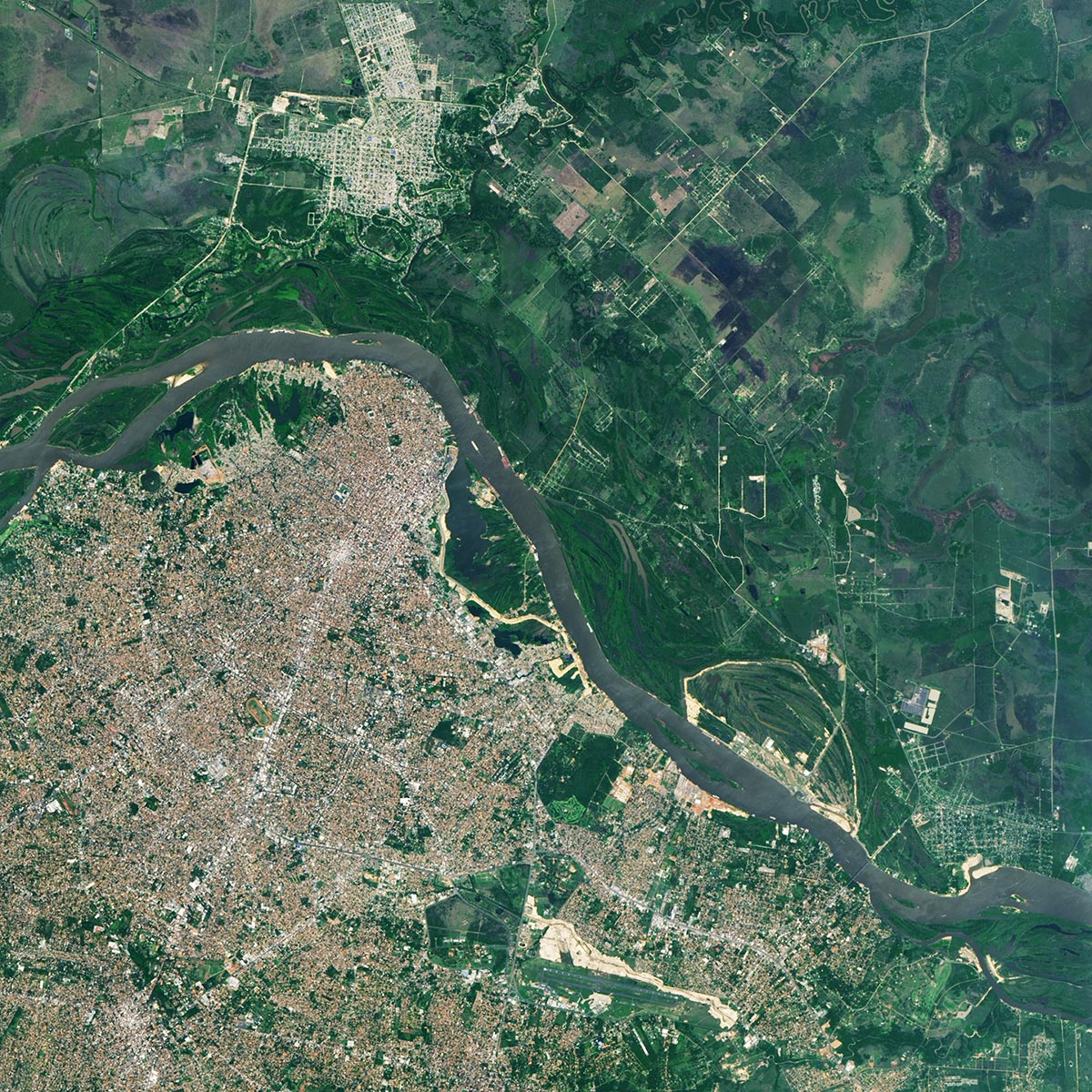
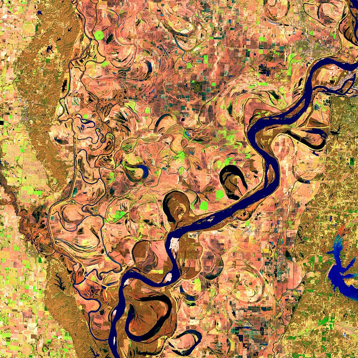
After
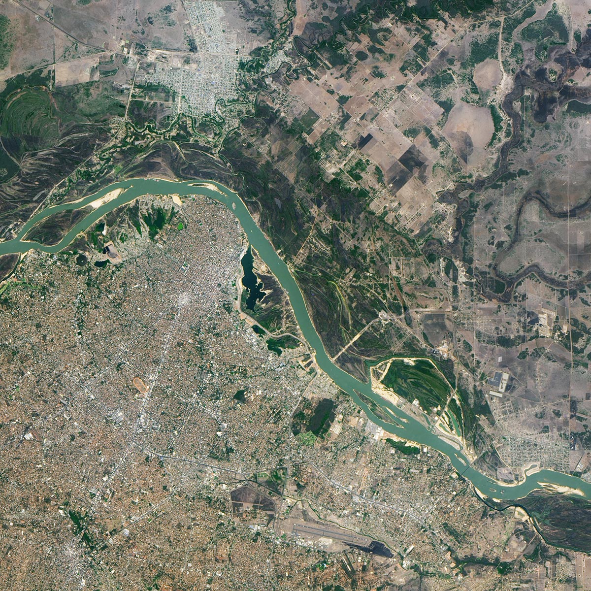
Before
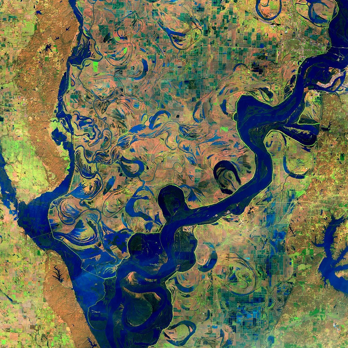
Satellite images of flooding along Mississippi River, taken 2014 (Before) and 2019 (After). (NASA, Images of Change)
Please provide us with your details to download the free eBook.
By clicking “Submit”, I agree to GIS People’s Privacy Policy.
Adding {{itemName}} to cart
Added {{itemName}} to cart