Type and hit enter
Type and hit enter
Site selection is a geospatial activity which refers to the process of identifying and selecting the best location or site for a specific requirement, using geospatial data and tools. This can be applied to a wide range of scenarios, from selecting the best location for a new retail store or warehouse, to identifying the ideal location for a renewable energy plant or transportation hub.
By leveraging geospatial data and tools for site selection, organizations can make more informed decisions that are based on data-driven insights. This can help them to reduce costs, minimize risks, and maximize the return on their investments.
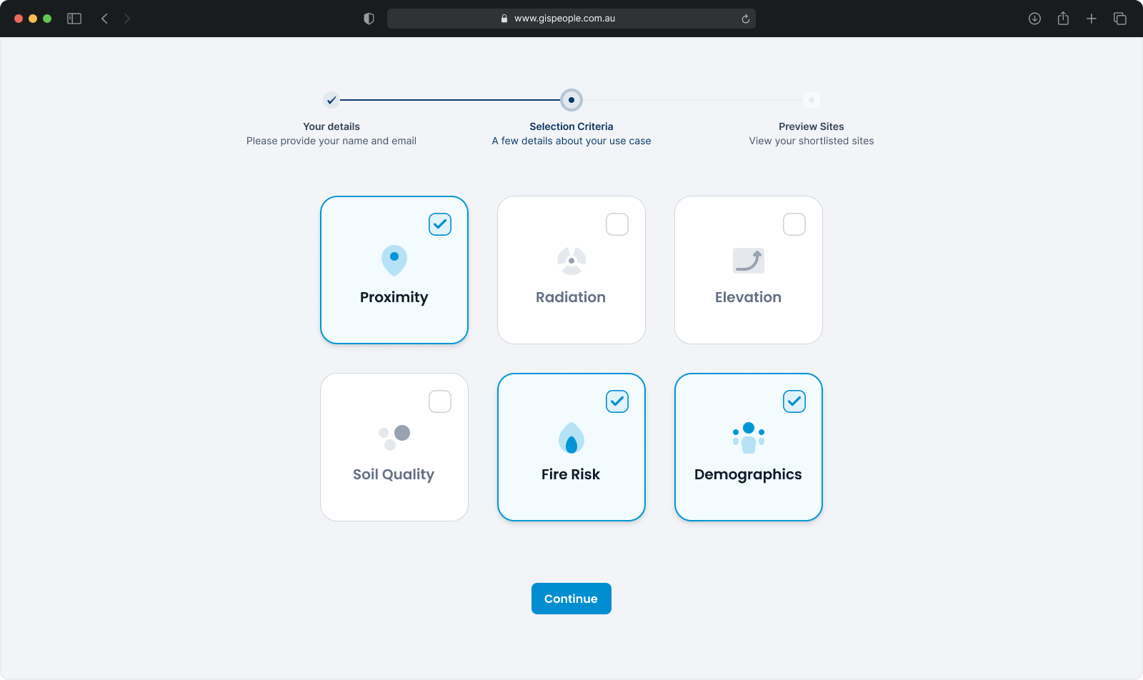
The first step is to understand the specific requirements and decision criteria for selecting the best location or site. This involves identifying the factors that are most relevant to the decision-making process, such as proximity to certain facilities, soil type, elevation, flood or fire risk, wind speed, solar radiation, or demographics. We’ll work with you to determine which factors are most important for your particular use case.
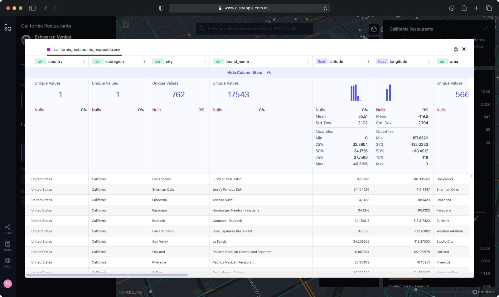
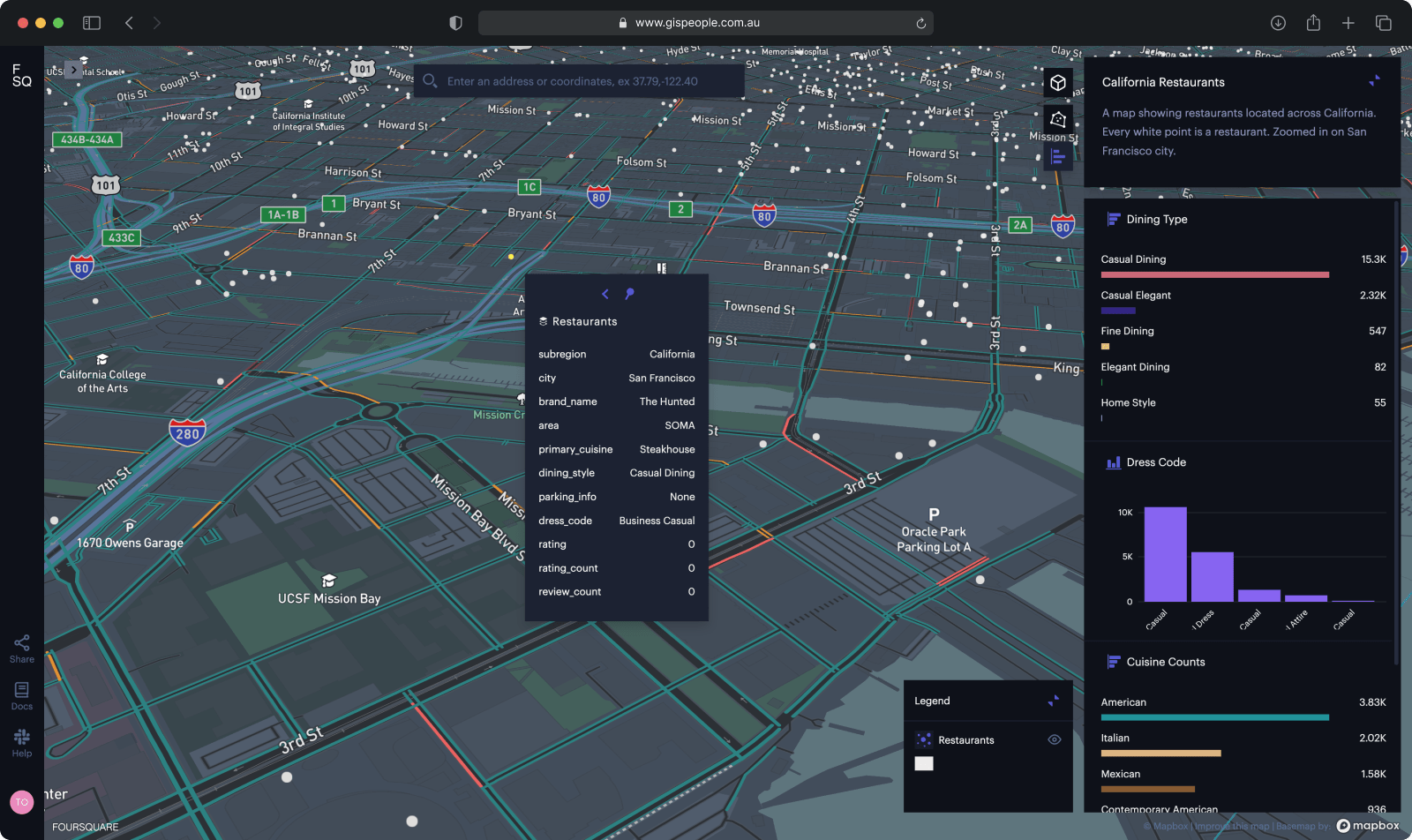
The next step is to collect and analyze relevant geospatial data which is typically done using geographic information systems (GIS) in combination with satellite imagery, aerial photography, sensors and other data that is relevant to the decision criteria. Once we have the data we visualize it, creating maps and other visualizations that help identify the best location or site based on the decision criteria.
Based on the results of the analysis, we can then evaluate potential sites and make a recommendation to you. This may involve identifying several potential sites and comparing them based on the decision criteria, or it may involve identifying a single, optimal site.
Please provide us with your details to download the free eBook.
By clicking “Submit”, I agree to GIS People’s Privacy Policy.
Adding {{itemName}} to cart
Added {{itemName}} to cart