
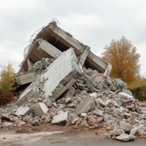
GIS (Geographic Information System) technology has revolutionized the way we approach handling asbestos and other hazardous materials. With its powerful mapping capabilities, GIS enables us to effectively manage the health and safety of employees, contractors, and the general public. In this article, we will explore the numerous applications of GIS in asbestos and hazardous materials management.
Health and safety of employees, contractors and the general public
 The well-being of individuals should always be our top priority when dealing with asbestos and hazardous materials. GIS plays a crucial role in ensuring the health and safety of everyone involved. By mapping the location of asbestos-containing materials, we can accurately assess the risks and implement appropriate measures to protect workers and the public.
With GIS, we can create comprehensive registers and maps that document the presence of asbestos and other hazardous materials in buildings and infrastructure. These registers and maps not only assist in planning and decision-making but also aid in emergency situations, where immediate actions may be required.
Moreover, GIS technology allows for real-time monitoring of air quality and environmental conditions in areas where asbestos removal or remediation work is taking place. This monitoring ensures that exposure levels are within safe limits and that all necessary precautions are being followed to prevent any health risks.
Furthermore, GIS can be utilized to track the training and certification status of personnel involved in asbestos management. By maintaining up-to-date records of training achievements and certifications, organizations can ensure that only qualified individuals are handling asbestos-related tasks, thus minimizing the chances of accidents or mishandling.
Audits, Registers and Maps
 Regular audits are essential for maintaining a safe working environment. GIS allows us to conduct thorough audits by capturing and analyzing data related to asbestos and hazardous materials. By integrating GIS with other systems such as building information modeling (BIM), we can ensure accurate and up-to-date information is readily available.
Registers and maps generated using GIS provide a comprehensive overview of the presence of asbestos and other hazardous materials. These visual representations enable us to identify high-risk areas, prioritize remediation efforts, and allocate resources efficiently. GIS maps can be easily updated as new information becomes available, ensuring the accuracy of the data at all times.
Moreover, GIS technology offers the capability to overlay multiple data layers, allowing us to visualize not only the presence of asbestos and hazardous materials but also factors such as proximity to water sources or population centers. This holistic view aids in making informed decisions regarding remediation strategies and emergency response planning.
Furthermore, the integration of real-time monitoring systems with GIS enhances our ability to track changes in environmental conditions and promptly address any emerging risks. By utilizing GIS in audits, registers, and maps, we are not only ensuring regulatory compliance but also fostering a proactive approach to safety management within our working environment.
The Role of Sampling and Accredited Laboratory Services
 Accurate sampling and analysis are crucial in identifying the presence of hazardous materials, including asbestos. GIS technology helps streamline this process by integrating laboratory data with geographic locations. By linking sample results to specific sites on the map, we can easily visualize the distribution of asbestos and make informed decisions about mitigation strategies.
Accredited laboratory services play a vital role in providing reliable data for GIS analysis. Laboratories equipped with state-of-the-art equipment ensure accurate testing and analysis of samples, enabling us to assess the extent of contamination and develop appropriate remediation plans.
Moreover, the use of cutting-edge technologies such as mass spectrometry and electron microscopy in accredited laboratories enhances the precision and reliability of asbestos identification. These advanced techniques allow for the detection of trace amounts of asbestos fibers in various environmental samples, ensuring a comprehensive understanding of the contamination levels present.
Furthermore, accredited laboratories adhere to strict quality control measures and participate in proficiency testing programs to validate the accuracy of their results. This commitment to excellence ensures that the data generated is not only credible but also meets regulatory standards set forth by environmental agencies.
GIS in Air Monitoring and Clearances
 Proper air monitoring is essential during asbestos removal projects. GIS technology enables real-time monitoring of air quality, ensuring that workers and the surrounding environment are not exposed to hazardous particles. By integrating air monitoring data with GIS maps, we can quickly identify areas with potential contamination and take immediate action to mitigate risks.
Clearances, which certify that an area is free from asbestos, are an essential step in ensuring the safety of occupants and workers. GIS tools aid in the efficient management of clearance processes by tracking areas that have undergone proper remediation and documenting the results. This transparent and systematic approach promotes accountability and provides stakeholders with confidence in the clearance process.
Moreover, GIS technology allows for the visualization of historical air monitoring data, enabling trend analysis and long-term planning for air quality management. By overlaying past monitoring results with current data on GIS maps, patterns and hotspots of contamination can be identified, leading to targeted interventions and preventive measures.
Additionally, the integration of GIS with Building Information Modeling (BIM) systems enhances the efficiency of clearance processes by providing a comprehensive view of building structures and potential asbestos-containing materials. This integration streamlines the identification of areas requiring clearance, expediting the overall remediation process and ensuring compliance with regulatory standards.
Mapping Exposure Risks
Understanding the potential risks associated with asbestos exposure is fundamental to effective management. GIS allows us to map exposure risks by considering various factors, such as the age and condition of buildings, proximity to asbestos sources, and population density. By analyzing these risk factors spatially, we can prioritize actions, allocate resources, and implement mitigation strategies where they are most needed.
Why mapping known asbestos sites is crucial?
 The accurate mapping of known asbestos sites is of utmost importance in managing asbestos-related risks. GIS technology enables us to create comprehensive databases that house vital information regarding asbestos-containing materials. By mapping these sites, we can prevent accidental disturbance during construction or renovation projects, minimizing the risk of asbestos exposure.
Furthermore, having a centralized and up-to-date database allows stakeholders to easily access critical information, increasing the efficiency of decision-making processes. Accurate mapping reduces the likelihood of costly mistakes, saving time and resources in the long run.
In conclusion, GIS technology has revolutionized the management of asbestos and hazardous materials. By harnessing the power of mapping, we can ensure the health and safety of individuals, conduct thorough audits, analyze data from accredited laboratories, monitor air quality, map exposure risks, and properly manage known asbestos sites. Embracing GIS in asbestos and hazardous materials management is essential to protecting the well-being of employees, contractors, and the general public, ensuring a safer and healthier future for all.